Tracking a location from a photo
Tracking a location from a photo – When Details Reveal the Place
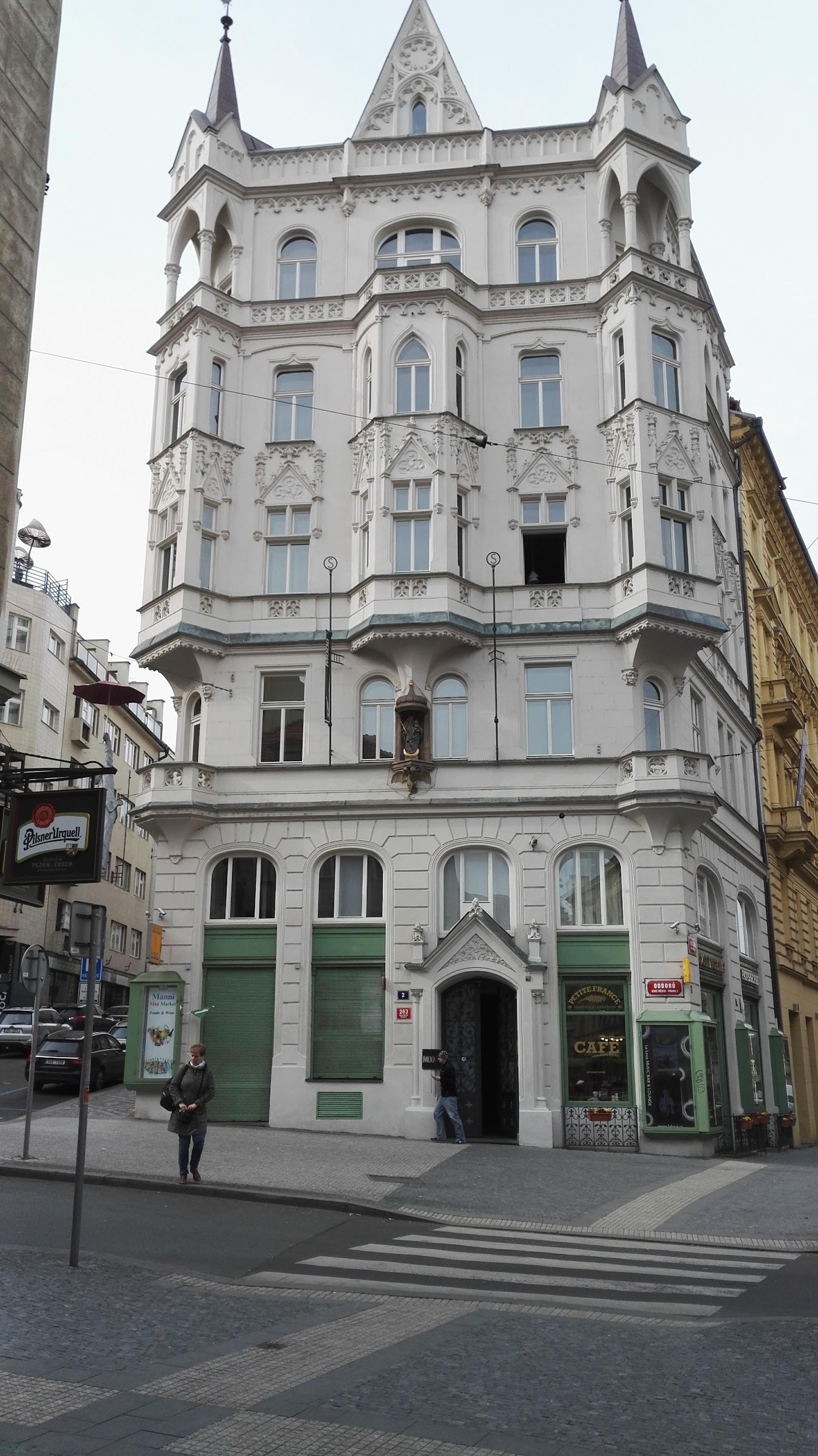
One of the key skills in OSINT is the ability to locate an image – that is, to identify where the photo was taken. Even if metadata has been removed or is missing, the image itself can contain numerous visual clues that can be used to determine the location accurately.
These clues can include, for example:
- Street or traffic signs
- Architecture and building styles
- Landscape features, such as mountains, coastlines, or vegetation
- Advertisements, store names, or language
- Vehicle license plates or color codes
- The position of the sun (shadows) for determining time and place
Using these, a hypothesis about the possible location of the image can be formed, and then verified using mapping services (e.g., Google Maps, Google Street View, Mapillary, Yandex Maps).
An example of such an event. You receive an image in which:
- A traffic sign that reads "Sörnäisten rantatie"
- Red and white street sign → Helsinki city's characteristic style
- Bus stop displaying line 55
- A well-known landmark visible in the background: Kallio Church
With these clues, you can open Google Maps and search for Sörnäisten rantatie → use the Street View feature → compare the camera angles based on buildings and landmarks → confirm the location.
Next, try to find the restaurant in front of which this photo was taken
Learn to hack — start here
Hundreds of interactive courses, virtual labs and CTF challenges in your browser. Start a free trial — no card required.